Here you can find us
Address
Camping site in the city of Cologne
Weidenweg 35
D-51105 Cologne Poll
Phone:
00 49 (0) 221/ 83 196 6
info@camping-koeln.de
www.camping-koeln.de

On foot & by car
Directions
Arrival by public transport:
From the DOM/HBF, take subway line 16 toward Bonn to the Heinrich-Lübke-Ufer stop. Get off there and walk across the Rodenkirchen Bridge—about a 20-minute walk (1.4 km)—to the campground on the opposite bank of the Rhine! You can also see it from the bridge.
Or you can take line 7 from Neu- or Heumarkt in the direction of Porz to Salmstraße in Poll, from there either take a cab (approx. 6 – 8 euros) or walk in the direction of the Rhine, approx. ½ hour (1.7 KM).
Traveling by car:
From the A4, take the Poll exit toward the city center. After a few kilometers, turn left under a railroad bridge onto the street “Am Schnellert.” Continue to the end of that street. Then turn left onto Alfred-Schütte-Allee and keep going straight. At a sharp curve, turn right onto Weidenweg. Drive through it, and you’ll be here in no time: Weidenweg 35 in 51105 Cologne-Poll. Or just follow your GPS.
BUT PLEASE NOTE: You cannot drive through Alfred-Schüttee Allee from 6:00 p.m. on Friday until early Monday morning. During this time, please take Salmstraße through the residential area, turn right at the end, and then turn left into Weidenweg at the sharp curve.
For the sake of nature
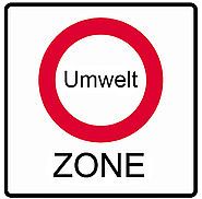
Low emission zone
Navigation
GPS
DG
(decimal degrees)
Latitude: 50.90269° N
Longitude: 6.99111° E
GMS
(degrees, minutes, seconds)
50° 54′ 9.684” N
6° 59′ 27.995” E